mail_outline sales@mediastorehouse.com
Casa Museo José Alfredo Jiménez, `José Alfredo Jimenez´ by Octavio Ocampo, Guanajuato 13, Dolores Hidalgo, Guanajuato State, Mexico
Colorado State capitol building at sunset Colorado State capitol building at sunset
National coat of arms of Sweden.National coat of arms of Sweden National coat of arms of Sweden. Staatswappen von Schweden. Caution: For the editorial use only. Not for advertising or other commercial use! Copyright by Peter Probst.
Solemn exit of the Russian Emperor Alexander III Alexandrovich and Empress Maria Fedorovna from the Moscow Kremlin on the day of coronation on May 15, 1883. Painting by V. Vereshchagin, 19th century
Vector map of Chuuk State, Federated States of Micronesia
Save Download Preview Kentucky State Parks Scenery. View and from under the stone arch in Natural Bridge State Park
Japan political map with capital Tokyo, national borders and important cities. English labeling and scaling. Illustration
MALIBU, UNITED STATES - OCTOBER 9, 2014: Beautiful and romantic El Matador State Beach in Southern California MALIBU, UNITED STATES - OCTOBER 9
Howard Clifford running off the Tacoma Narrows Bridge during collapse, Tacoma, Washington
Map of the United States and Unorganized Public Lands in 1825. Color lithograph Printed color lithograph
San Luis Obispo, California, map 1956, 1:250000, United States of America by Timeless Maps, data U.S. Geological Survey
Modern City Map - Jersey New Jersey city of the USA with neighborhoods and titles
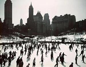
1950s LARGE NUMBER OF PEOPLE ICE SKATING ON WOLLMAN RINK CENTRAL PARK MANHATTAN NEW YORK CITY USA
Nepal political map with capital Kathmandu, national borders, cities and rivers. Federal democratic republic Nepal political map with capital Kathmandu, national borders, cities and rivers
Map of China with showing the provinces, autonomous regions and municipalities, with a clipping path, isolated on a blue background
Northeast, U.S. census region, multi colored political map. Census region 1 of the United States, consisting of 9 single states. Colored silhouettes Northeast, U.S
India map Map of the Republic of India with the states colored in bright colors
Bangladesh map Map of People's Republic of Bangladesh with the provinces colored in bright colors
UK map vector - important cities marked on map of the United Kingdom
bangladesh administrative and political vector map
The Americas, single states, political map with national borders. Caribbean, North, Central and South America
Map of United States split into Census regions and divisions. Region definition, widely used for data collection and analysis Map of United States split into Census regions and divisions
The detailed map of the India with regions or states and cities, capitals and Sri Lanka
California Live Oak tree adjacent to the London cottage, Jack London State Historic Park, Glen Ellen, California